|
THIS PAGE IS A FEATURE OF THE PHILATELIC EXPERTS WEB SITE SMALL ISLANDS IN THE NEAR EASTTo the mobile version
RUAD / ARWAD or ARVAD
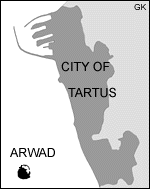
Eng.: Ruad, French: Île Rouad, Greek: Arados, Aradus. The only island in Syria, located south-west of Tartus, 2½ km (20 min. by boat) off coast. The town of Arwad (pop. 3 000 in 1904, same today) takes up almost the entire small island, a rock some 740 m long by 400 m wide, 0.2 sq. km. There is not a single tree. Arwad, known since the 2nd millennium BC, was one of the most important city-kingdoms of Phoenicia, which remained independent until about 500 BC. Later Arwad was the last Crusader stronghold in the region, fell to the Arabs in 1302 and to the Ottomans in 1516. Apart from the Crusader fort (see the 1996 photos) there is the Arabic Ayyubi Citadel (in the port). The former was the WW1 French headquarters and was later used as a prison during the resistance against the French mandate over Syria. Today Arwad lives mainly from tourism and by fishing.
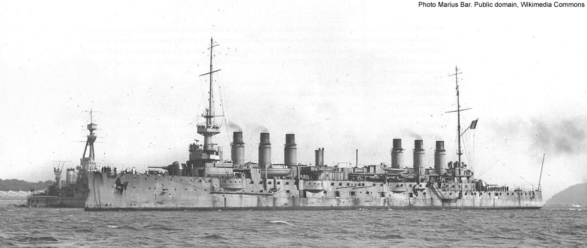
On 1 Sept. 1915 it was the first point in Syria to be occupied, by the French Navy (cruiser Jeanne d'Arc). (Damascus was to be taken only on 1 Oct. 1918.) The administrator, General Trabot, had the consent of the inhabitants. Originally Jazirat Arwad was occupied in order to materially support Christians (e.g. Maronites), oppressed by the Turks, in Lebanon, and as an intelligence centre. (There had been massacres of Christians in the Ottoman Empire in May 1915 and then there was a severe famine in Lebanon due to the war.) Occasionally the island was bombarded by the enemy. In the spring of 1916 a civilian post office opened and Arwad got its own stamps, French ones overprinted Île Rouad. These were replaced in 1919 by the general issues for French-occupied Syria (T.E.O.). The first overprint (5 April) is locally hand-stamped (two types) and a speculation of the stamp dealer Félix Cohen. The definitive overprints arrived around Nov. 1916. In 1921 the islet was attached to the Territory of the Alaouites (later named Latakia, now part of Syria). Cf. Arab Kingdom of Syria. KASTELLORIZON / CASTELROSSO
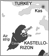
Also Castellorizo, Meyisti. Above: Greek/Italian, Turkish: Meis, ancient name: Megiste. 125 km east of Rhodes, 2½ km off coast of Turkey (nearest town: Kas), 9 sq. km, 273 m high, population 5 000 (1910, 15 000 in 19th century, 2 200 in 1936, now only 200). In 1943–4 he population, entirely Greek, was removed and many houses were destroyed in an explosion (compare the pictures). Most islanders have emigrated to Australia and other countries. Medieval Crusader castle, Blue Cave and other sights. When the rest of the Dodecanese islands were occupied by Italian forces in May 1912 Kastellorizon remained nominally Turkish. On 1 Jan. 1913 the inhabitants, however, declared the island to be part of Greece and Greek soldiers from Samos arrived (left in Oct. 1915). Turkey did not react.
On 24 Dec. 1915 the French Navy, First Fleet Third Squadron, occupied the island; Greece protests. In 1917 Turkish shore-based artillery sunk the British seaplane carrier Ben-my-Chree here. By Treaty of Sèvres 1920 Turkey ceded Kastellorizon to Italy, effective 1 March 1921, and on 21 Aug. 1921 the French Navy set sail. In the 1920s–30s it was a seaplane stop-over. Occupied by the Germans in 1944 and by the British in 1943 and 1945. In March 1947 the administration of all the Dodecanese was taken over by Greece. In the 1960s Greece offered Kastellorizon to Turkey in exchange for Enosis (union with Cyprus). Important for the Levantine timber trade and freight in the 19th century, fishing and (yacht) tourists now means a lot. In 1986 a 799 m airstrip was constructed and in 2003 the tiny island was the scene of the meeting of European Union foreign ministers.
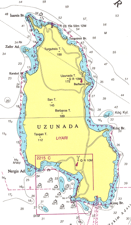
Turkish postmark. 1913–15 ordinary Greek (and this) stamps were used. In July 1913 a set of 12 stamps were overprinted vertically, but this is not an official issue. After 1915 French Levant stamps (1–50 c) were sold in Kastellorizon. Only in 1920 did the French issue special, locally overprinted stamps for this island. A fourth set was made in the last minute, and is considered bogus. The Italians produced five Castelrosso sets; otherwise the general Egeo issues were current. During the British occupation 1945–47 GB stamps overprinted M.E.F., and in 1947 Greek with S.D.D., were used in the Dodecanese. You can see samples of the stamps here. A modern Greek stamp, and a modern bogus one. LONG ISLAND / UZUNADA or KEUSTANTurkish: Uzun Ada (Uzun Adasi, Uzan Ada, previously called Keustan, Chustan or Kösten), Greek: Makronisi, renamed Long Island by the British soldiers. 25 sq. km, 202 m high. Strategically situated it controls the entrance of Izmir (then called Smyrna), and is still restricted Turkish Navy area. The island was occupied in April 1916 by the Fourth Squadron of the Royal Navy, Mediterranean Fleet, with the monitor M30, blockading the Gulf. The coast of Asia Minor had been under bombardment since early 1915; the Gulf of Izmir was under fire in March 1915.
On 14 May
the M30 is hit by Turkish shore-based gunfire and sinks. With the airfield
also unusable Long Island is abandoned on 26 May. A "post office" was
opened on 7 May and typewritten stamps were issued in very small numbers.
They were, of course, not really necessary, and only Gibbons is listing
them, at high prices. The stamps were not meant for the few local
inhabitants (now there are no civilians). In Jan. 1919 Uzun (as well as other Turkish fortifications in
the Gulf) was briefly taken control of by the Royal Navy in support of the Greek
occupation of the Izmir region. Further reading: Fred. J. Melville, Stamp Books No. 22, London
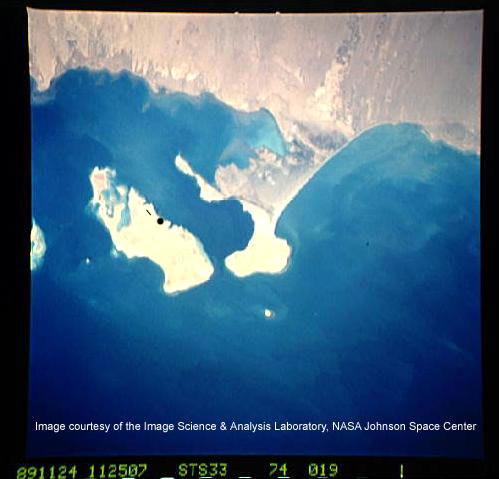
1916. KAMARANThis island in Yemen was occupied by the British in 1915 (June?). It had belonged to the Ottoman Empire since 1872. In 1858 Britain had occupied the island to protect the submarine cable to India. According to a 1910 encyclopædia the British had bought Kamaran (Camaran, Qamaran, Karahan) in 1859 from an Arab sheikh, but they were perhaps unable to enforce their right of possession. Maybe that is why the British occupied Kamaran and kept it – and not some other Ottoman island in the Red Sea. It has also been claimed by Italy.
The island is 108* sq. km (18
km by 7 km), and only had 100 permanent inhabitants in 1910 (2 000 in 1954).
Still the Turks had long maintained a post office here. The explanation is
that since the last decades of the 19th century Kamaran had been the most
important quarantine station for northbound pilgrims, tens of thousands per annum, to Mecca. The quarantine was mandatory. The British constructed a
large camp, but it soon became deserted (closed in 1952) as Saudi Arabia built its own
quarantine stations. Kamaran was administered from Aden (subsequently South Arabian
Federation), which became independent in 1967 as South Yemen. The island
was, however, seized by the adjacent Yemen Arab Republic in 1972. In 1990
the two Yemens were unified. The main town is Kamaran on the east
coast (marked •, with the airstrip). Copyright © 2006–2011 by G. Kock |


